7. The Pacific Ocean
Massive tree-limbs stranded some twenty-metres above the water across the head of Dumbarton Rock provided a humbling reminder of the river’s power.
Tree-limbs stranded on Dumbarton Rock.
Beyond Miller’s Flat, signs of settlement faded, and we entered what seemed to be a most inaccessible and beautiful part of the Clutha – perhaps the most hidden and forgotten. Rocky hills, becoming greener, alternately confined and released the river across wide, rock-strewn rapids. All this, too, was threatened by hydro-electric inundation.
At the Lonely Graves, we pulled in beside a grassy, tree-shaded bank and visited the graves of “Somebody’s Darling”, and that of William Rigney himself – who according to the legend, had found and buried the handsome, nameless young man, who had drowned in the river.

The Lonely Graves.
Setting out again, we rafted through the remote Beaumont Gorge, intending to make camp at Beaumont.

Beaumont Gorge.
Mist was on the river as we emerged from our frost-covered camp near the Beaumont Bridge.
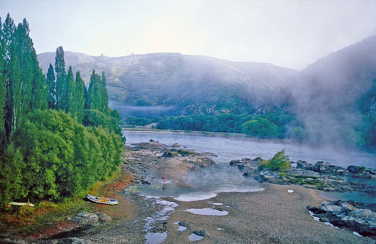
Morning mist at Beaumont.
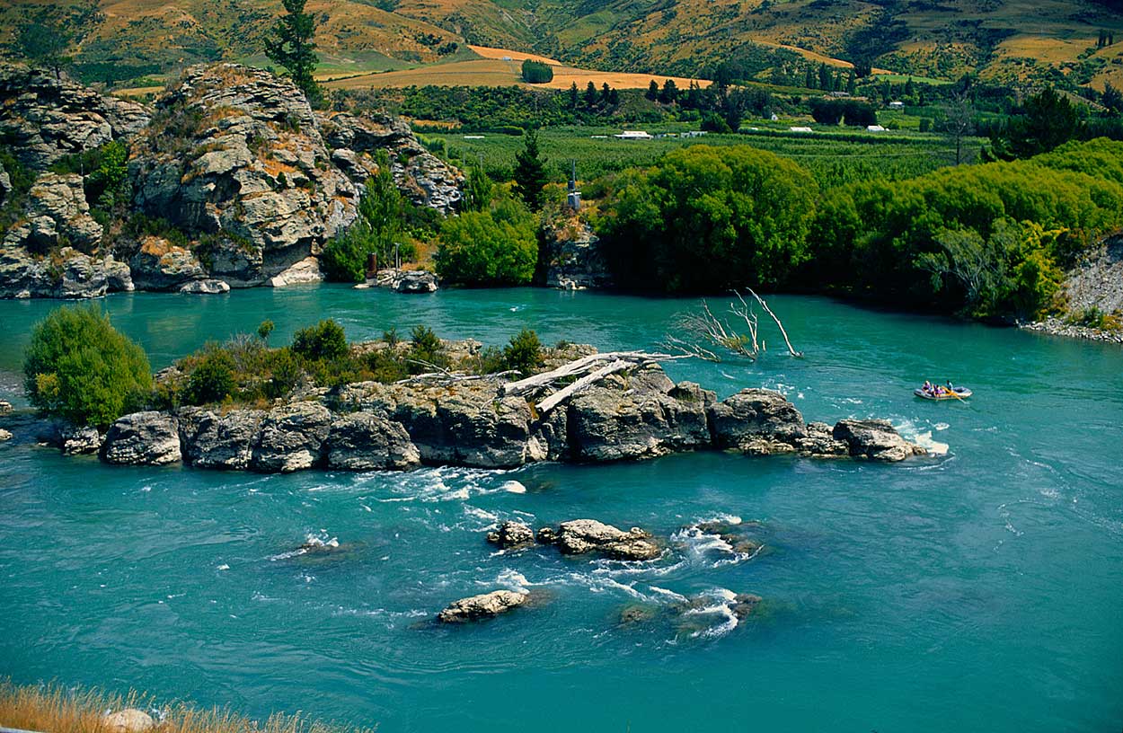
The Rongahere Gorge lay ahead, and we were not disappointed. A forest corridor of native trees embraces the huge river for hour after hour. Near the head of the gorge we passed Birch Island, a protected sanctuary for rare species.

Birch Island, in the Rongahere Gorge.
In the distance, exotic pine forests blanketed the rolling Blue Mountains. Somewhere here, as we approached Tuapeka, was the site of the proposed dam that would flood the entire river valley back to Miller’s Flat, disposing of some of the most beautiful regions of the Clutha River.
Coming out of the forest country at Tuapeka, we passed the only remaining ferry-punt on the Clutha, still in use – a remarkable reminder of about two dozen such punts that once worked the river.

Tuapeka Punt.
The landscape fell open now and the wind blew upriver against us so that we sought the current and paddled constantly. At Clydevale we pulled in hoping to find the shop open, but no luck – it was Waitangi Day. Here, years earlier, I had flipped a four-tonne log-raft against willows while coming in to land near the bridge, and so I was at least pleased to visit again without mishap.
Near Clydevale, we found an old steam locomotive half-submerged. We later learned that were two of them, and that there were plans to haul them out for restoration.

Steam locomotive.
Willow snags now infested the river and navigating the correct channel became essential. Swans, geese and countless ducks shied away in flight. Above Balclutha, at the head of an island, railway irons had been driven into the river-bed in an effort to force the river into the right-hand channel, but the river had wanted to go left – so it did. We slipped through a gap in the steel teeth.
Flood protection stop-banks, or levees, now lined the broad river. At 7pm, with the evening breeze still against us, we landed at the Balclutha Bridge.

Approaching the Balclutha Bridge.
Between Balclutha and the ocean the Clutha River divides into the northern Matau Branch and the southern Koau Branch. Inch Clutha, meaning “Clutha Island” in Gaelic, is the large delta island in the middle. The hinterland lies beyond stop-banks. In times of flood, we were told, there is a stop-bank “plug” near the head of Inch Clutha, which can be blasted away to flood the island and so lower the river level quickly, protecting Balclutha.
We guided the raft out the meandering Matau Branch on an ebb tide. The river was now more like a canal, lined with sheep, cattle and old homesteads. Landing at Kaitangata briefly, we chatted to some locals. This once rich coal town closed down its underground mines years ago, after a tragedy, and has embarked on a quiet life.
The riverbanks were soon given over to a procession of duck-shooting hides and fishing-shanties, assembled according to no design known to mankind. The pounding surf was at last in sight. A group of kahawai fishermen were sitting on the point as we approached the mouth, battling a head-wind.

Entering the Pacific at the mouth of the Matau Branch.
After six days on the river of gold our raft finally broached the surf of the Pacific coastline. We headed far out into the breakers, spun around, and surfed back to the beach on the breakers, enjoying ourselves as much as the hundreds of kahawai who were surfing alongside us.

Surfing.

Journey's end.
At journey’s end, we had travelled 338km, down the combined waters of New Zealand’s largest, most spectacular river system, encompassing a catchment of 21,960 square kilometres.
Like many great rivers around the world, the Clutha is suffering and under pressure. Its future is also our own. We overlook, and undervalue, at our peril, this most precious lifeblood that flows through the heartland of Otago.
End.
